
By T.J. Zenzal
It is hard to believe that many of the small “backyard birds” people see during spring and autumn can make migratory journeys that span thousands of kilometers. In fact, over two-thirds of all land birds (i.e., those not associated with aquatic habitats) and over half of the migratory species in North America move long distances to areas in Mexico, Central and South America, and the Caribbean islands. Some have argued that long-distance migrants experience the best of two worlds by virtue of their migratory strategy: increased reproductive success by breeding in food-rich, competitor-poor temperate areas and increased survival by wintering in warmer tropical areas. However, traveling long distances across areas that vary physiographically comes with considerable risks, and the mortality associated with long-distance migration may be substantial, especially among young, inexperienced birds making the journey for the first time.
Although many migratory land birds are capable of making spectacular, nonstop flights over geographic barriers, including the Sahara Desert, the eastern Atlantic Ocean, and the Gulf of Mexico, few actually fly nonstop from their point of origin to their final destination. Rather, they make periodic stops lasting a few hours to a few days before resuming migration. The place where a migratory bird pauses for some length of time between migratory flights is called a stopover site. For birds crossing the Gulf of Mexico that must contend with a 13 to 32 hour nonstop flight, the habitats along the northern Gulf of Mexico coast provide the last possible stopover before autumn migrants make a nonstop flight south and the first possible landfall for birds returning north in the spring.
Typically, land birds use unique stopover sites during each migration, which differs from other avian taxa groups that may have familiar staging areas during migration (e.g., waterfowl, shorebirds). This means that land birds must negotiate unfamiliar surroundings at a time when energy demands are likely to be high, balance conflicting demands between predator avoidance and food acquisition, compete with other migrants and residents for limited resources, endure unfavorable weather, and possibly resolve orientation errors all at an unfamiliar stopover site. It is not surprising that a migrant’s ability to offset the costs of migration depends on its capacity to solve problems encountered during stopover. How well a bird solves problems during migration determines the success of migration, which is measured in terms of survival and reproductive success.
An alarming number of migratory bird species are experiencing declining populations, and mortality rates are thought to be the highest during the migratory period. Although debate over the causes of decline continues, attention has focused on events associated with the breeding and wintering phases of the migrant’s annual cycle. However, the importance of stopover habitat during migration has been largely overlooked in the development of conservation strategies. Unless habitat requirements during migration are met, conservation measures focused on temperate breeding grounds and/or Neotropical wintering areas will be compromised. Protected areas are most critical before and after migrants cross geographic barriers. Unfortunately, the availability of coastal habitats is often at odds with natural and anthropogenic disturbance, possibly causing migrants to make longer nonstop flights in order to utilize suitable habitat located further inland. In the United States, coastal counties and parishes account for 8% of the total land area in the country, yet contain 39% of its population; moreover, between 1960 and 2008, the Gulf of Mexico region’s population increased by 150%. The disproportionately high rate of human development along the northern Gulf of Mexico coast coupled with the importance of coastal areas for land bird migrants creates urgency for conservation and management of important coastal areas.
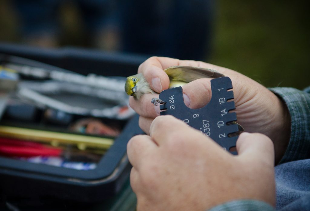
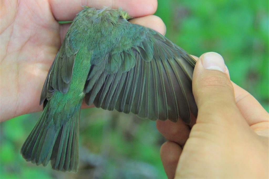
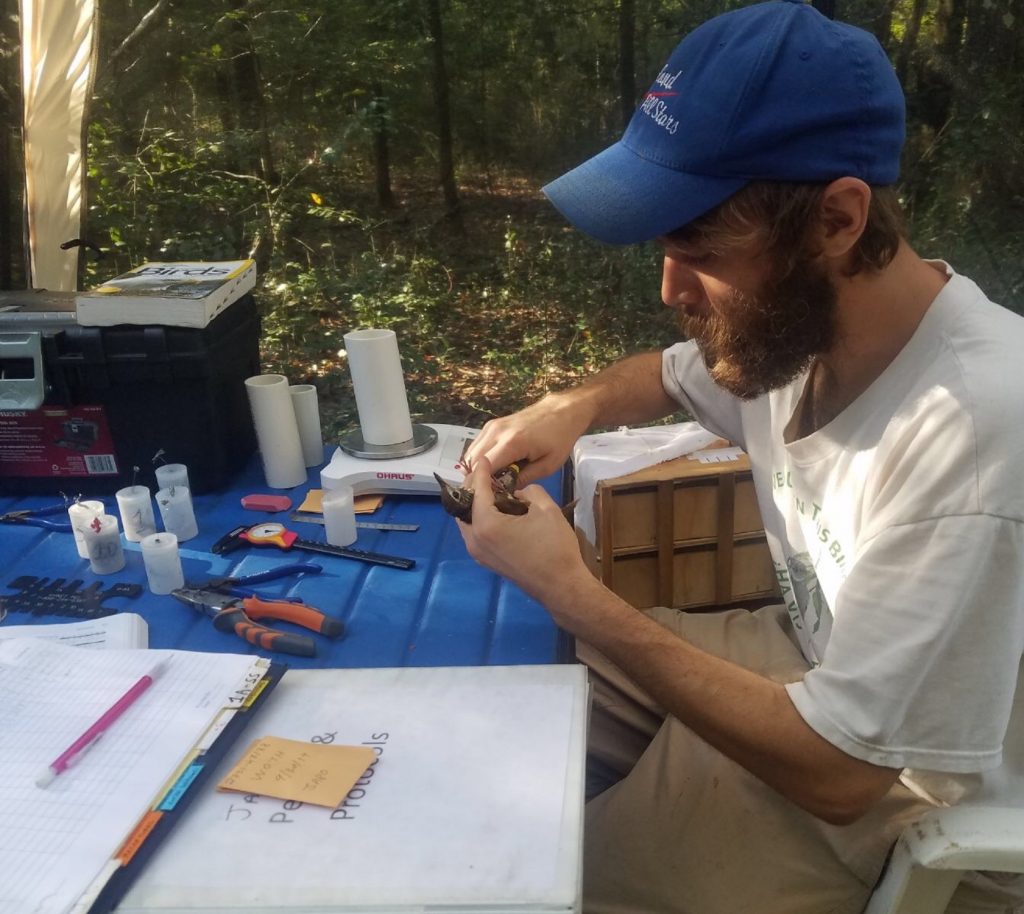
Given the many challenges land birds face, our goal is to develop a multi-scale approach that will assist in developing effective conservation strategies and pragmatic land management plans aimed at protecting populations during the often-overlooked phase of migration. This project will develop a better understanding of migratory land bird habitat use along the northern Gulf of Mexico coast to inform habitat decisions for land managers and conservation planners. At six stopover sites in Alabama and Louisiana, we are studying migrant land bird use of stopover habitats that differ in their function for migrants (e.g., resting or feeding), measuring migrant habitat-use relative to current habitat management efforts, and assessing if weather surveillance radar can serve as an effective conservation tool for migratory birds. Weather surveillance radar and land cover maps will be used to predict migratory bird stopover habitat use throughout the entire northern Gulf of Mexico region. Weather radar enables us to measure the response of migratory land birds to management efforts, including habitat protection and restoration programs.
To assist land managers and conservation planners who are tasked with making decisions about how best to conserve stopover habitat, we are developing a bioenergetic model to determine the energy needs of land birds, and the resources available to them along the northern Gulf of Mexico. The model will pair the data on bird movement captured by the weather radar with on-the-ground site surveys to determine the amount of potential food sources available to birds at different locations and what that means for the number of land birds the stopover locations could support. Ultimately, we plan to create a region-wide map of migratory songbird stopover habitats and resource availability to gauge if stopover habitats are adequately supporting birds. In addition, this map will allow land managers to identify locations whose conservation would provide the greatest benefit to migrating songbirds.
We completed the last season of data collection in November 2019 and are working on building the bioenergetic model. In addition to the model, the data we collected will be used to better understand bird migration at a large spatial scale during spring and autumn migration. Over the last two years we have also encountered some novel findings that require further study, such as snails that could be using the birds as a form of animal transport and birds captured by spider webs.